Steps, gradients & daily rhythm
Walking & Pace in Zhangjiajie
Distance is only one part of the effort. Steps, gradients, wet stone, standing time and transfers decide how a mountain day actually feels.
Zhangjiajie is not one continuous mountain climb. A day can weave together valley paths, ridge-top loops, sightseeing shuttles, an elevator and a cableway. Good planning is about where the walking happens - and how much recovery sits between those sections.
How effort works
Read the whole movement chain.
A route that looks long on a map may include substantial scenic transport. A shorter route can still feel demanding when the walking is concentrated on steps or a sustained ascent.
Distance is not difficulty
Four things change how the same day feels.
Gradient & steps
A steady uphill or long descent loads the legs differently from a level valley path.
Surface & weather
Stone, forest paths and viewing platforms need a slower pace when wet.
Standing & queues
Waiting for scenic transport adds fatigue even when it does not add kilometres.
Transitions
Repeated bus, elevator and cableway changes can make a day feel busier than the map suggests.
A pace-led day
Choose what to protect: distance, knees or time.
The planning framework below is a way to discuss comfort, not a universal fitness rating. The final route still depends on current operations, weather and the traveller.
Gentle
Prioritise scenic lifts, shorter marked walks and one main landscape zone.
Balanced
Combine a viewpoint loop with a valley or forest walk, leaving recovery between them.
Active
Use a dedicated hiking route and accept longer gradients as part of the day.
Official route examples
Compare the movement, not just the headline.
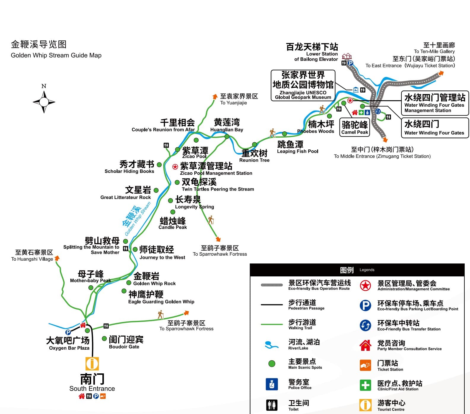
These figures are taken from the route diagrams in the official manual. They are examples for understanding effort, not a promise of exact personal timing.
Route operations, closures and real conditions must be rechecked for the travel date. Distances above reproduce the marked segments in the manual rather than estimating unlabelled sections.
Before the first step
Prepare for repetition, not expedition.
Shoes with grip
Choose comfort and traction for stone, steps and damp surfaces.
Light rain layer
Mountain weather can change the surface and the pace within the same day.
Downhill awareness
Tell the planner if descents, repeated steps or prolonged standing are the main concern.
Honest daily rhythm
Share how long you comfortably walk before you want a real seated break.
Questions visitors ask
Walking & Pace FAQs
Do I need to be a strong hiker?
No single answer fits every route. The manual shows both casual circuits using scenic transport and dedicated hiking routes with three- or four-star difficulty. Start with your comfortable walking rhythm, then choose the movement chain.
Can the elevator and cableways remove all walking?
No. They can reduce major elevation changes, but ridge loops, platforms, transfers and approaches still involve walking and standing.
What should I tell the planner?
Share your comfortable continuous walking time, whether steps or downhill are harder, and whether you prefer fewer transitions or more scenery in one day.
What happens if paths are wet?
The sensible response is a slower pace and a route recheck. Wet surfaces, visibility and transport notices may change the final sequence.